A fun, insider’s guide to Taiwan’s Baiyue — from iconic groups like the Five Greats to dreaded challenges like the Four Obstacles.
Looking at Taiwan’s 100 Peaks list — known as the Baiyue (百岳) — for the first time can feel overwhelming. Where do you even begin?
That’s where local hikers’ creative system of classification comes in.
Taiwanese hikers have come up with a brilliant, informal yet wildly popular system of “number-named” classifications. These groupings categorize standout peaks based on their unique features or difficulty. Famous examples include the “Five Greats,” “Three Spires,” “One Ogre,” and the humorously dreaded “Four Bird.”
More than just a list of peaks, these classifications offer a fun, culturally rich way to explore the Baiyue. If you’re looking for inspiration for your next Taiwan hiking adventure, this is the perfect place to start!
If you’re new to Taiwan’s Baiyue and not sure where to begin,
👉 start with this complete beginner’s guide to the origins, difficulty levels, and permit system.
Ready to unlock local lore and secret classifications behind Taiwan’s legendary 100 Peaks (Baiyue)? Let’s dive in!
*Note 1: These classifications are not official categories, but widely recognized among Taiwan’s hiking community.
*Note 2: “Shan” (山) means “mountain” in Chinese.
In this guide, mountain names follow the pinyin system commonly used in Taiwan’s hiking maps or trail signage (e.g. Nanhudashan, Xiuguluanshan, Qilai North Peak).
These peaks may also appear in alternative English forms such as “Nanhuda Mountain,” “Xiuguluan Mountain,” or “Kalaye Mountain.”
🏔️ Five Greats (五嶽)
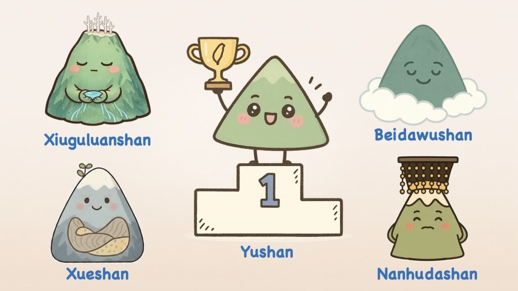
The Five Greats are Taiwan’s most majestic and symbolic peaks — long regarded as powerful guardians of the land, each symbolizing strength, stability and protection.
Their dramatic forms and sweeping vistas have earned them a legendary status among Taiwan’s high mountains.
- Yushan (Jade Mountain) 玉山 – 3,952m | Rank: #1
- Taiwan’s highest peak and the tallest mountain in Northeast Asia, making Taiwan the world’s fourth-highest island by elevation.
- Regarded as a sacred mountain by the Bunun and Tsou Indigenous tribes.
- Also considered a national icon of Taiwan, representing the island’s natural and spiritual heights.
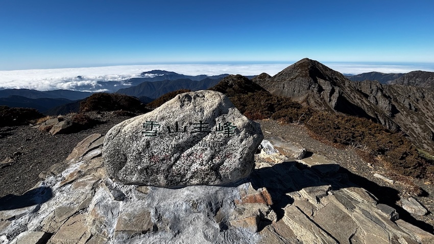
- Xueshan (Snow Mountain) 雪山 – 3,886m|Rank: #2
- Highest peak of the Xueshan Range and Taiwan’s second-highest.
- Famous for alpine rhododendron blooms in spring and snow-covered slopes in winter.
- Features several glacial cirques — with Cirque No.1 being the most spectacular.
(👉 Read the full Xueshan hiking guide for routes, permits, and planning tips.)
- Xiuguluanshan 秀姑巒山 – 3,825m|Rank: #6
- Highest summit in the Central Range, known for its precipitous terrain and razor-sharp ridges.
- Source of several major rivers.
- Features the famous Xiuguping (秀姑坪) — one of Taiwan’s three great white fir forests, known for its scenic saddle and striking stands of white deadwood trees (the others are at Yushan West Peak and Xueshan).
- Nanhudashan 南湖大山 – 3,742m|Rank: #8
- The highest peak in the northern section of the Central Mountain Range.
- Revered as Taiwan’s “Mountain of Emperors” for its imposing silhouette and majestic form.
- Showcases classic glacial landforms: U-shaped valleys, cirques, and remnants of ancient ice caps.
- Beidawushan 北大武山 – 3,092m|Rank: #90
- Southernmost 3,000m+ peak of the Central Mountain Range.
- Renowned for its sea of clouds, earning it the title “Hometown of Cloud Seas.”
- Trail features remnants of Japanese-era shrines, ancient sacred trees, and hemlock forests.
🔺 Three Spires (三尖)
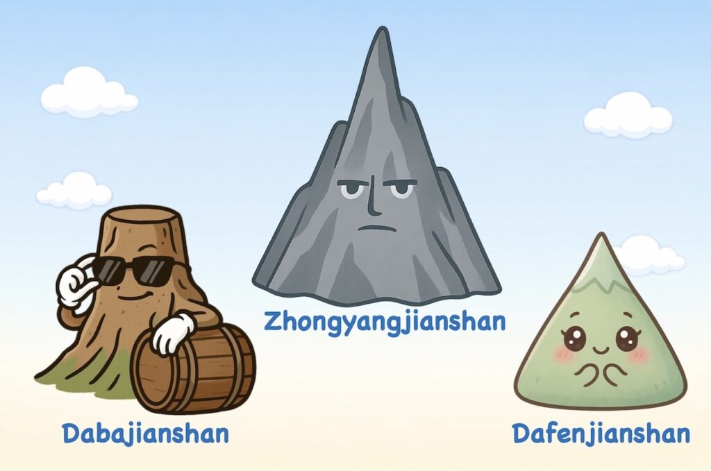
The Three Spires are sharply pointed, pyramid-like peaks with iconic silhouettes that pierce the sky.
They are famed for their striking forms and breathtaking summit views.
- Zhongyangjianshan 中央尖山 – 3,705m|Rank: #10
- A blade-like summit in the northern Central Mountain Range..
- Resembles a pyramid rising from the central ridge, earning the title “The Sharpest Peak on Formosa.”
- Its southern face features a deadly crumbling cliff known as the “Death Ridge.”
- Considered sacred by the Atayal Indigenous people.
- Dabajianshan 大霸尖山 – 3,492m|Rank: #28
- Famous for its distinctive barrel-like shape, earning the nickname “Barrel Mountain.”
- Features sheer cliffs on all sides where no grass grows.
- Long revered as sacred by both the Atayal and Saisiyat Indigenous peoples.
- Also known as “The Wonder Summit of the Century” for its grandeur and vertical cliffs.
- Dafenjianshan 達芬尖山 – 3,208m|Rank: #73
- The smallest of the Three Spires.
- Source of the Tafen River.
- Sharp and elegant, though less imposing than its spire siblings.
👹 One Ogre (一奇)
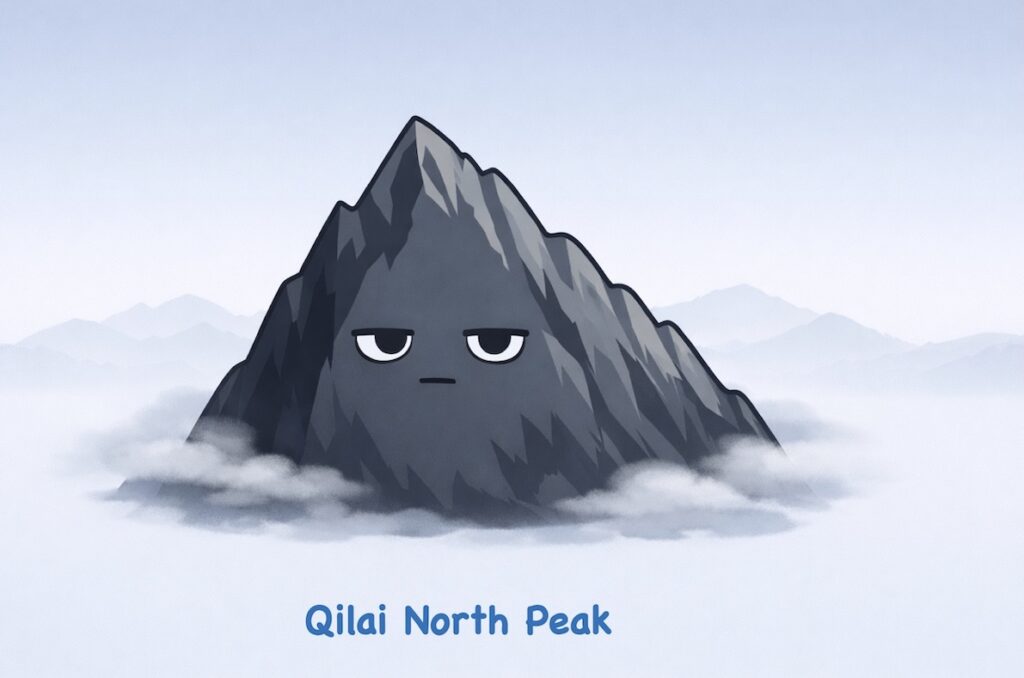
A single, fearsome peak with a deadly reputation — known for its dark slopes and treacherous terrain.
The title “One Ogre” refers specifically to Qilai North Peak, one of Taiwan’s most perilous high mountains.
- Qilai North Peak 奇萊北峰 – 3,605m|Rank: #16
- Notorious for its loose black slate, sheer cliffs, and rapidly changing weather.
- Its western face appears ominously dark before noon and is often shrouded in thick afternoon mist — earning it the name “Black Qilai.”
- One of Taiwan’s most accident-prone mountain areas, with the highest number of mountain fatalities.
✨ Three Stars (南橫三星)

These three majestic peaks shine along Taiwan’s Southern Cross-Island Highway — earning them the nickname “Three Stars of Southern Cross-Island Highway (南橫三星).”
Short in distance and mild in difficulty, each trail is ideal for beginner-friendly day hikes. Together, they offer diverse terrain and dramatic scenery, making them a perfect introduction to Taiwan’s high mountains.
- Kuhanosinshan 庫哈諾辛山 – 3,115m|Rank: #85
- The westernmost of the Three Stars.
- A relatively easy out-and-back hike (3.4 km one way) with dirt paths and wooden stairs.
- Though longer than the other two, it’s the most beginner-friendly in terms of terrain.
- Guanshanlingshan 關山嶺山 – 3,176m|Rank: #77
- A pyramid-shaped peak with sweeping views along most of the trail.
- The shortest of the three (1.5 km one way), and widely considered the easiest — with only a few rocky slopes near the summit offering mild challenges.
- It stands above the famous Guanshan Tunnel, a popular scenic spot along the highway.
- Taguanshan 塔關山 – 3,222m|Rank: #71
- The highest and easternmost of the Three Stars.
- A 2.2 km (one way) trail with mixed terrain — offering the most variety and challenge of the three.
- The most scenic of the three, offering dramatic views of Guanshan Cliff as it plunges to the riverbed below.
🌸 Four Beauties (武陵四秀)
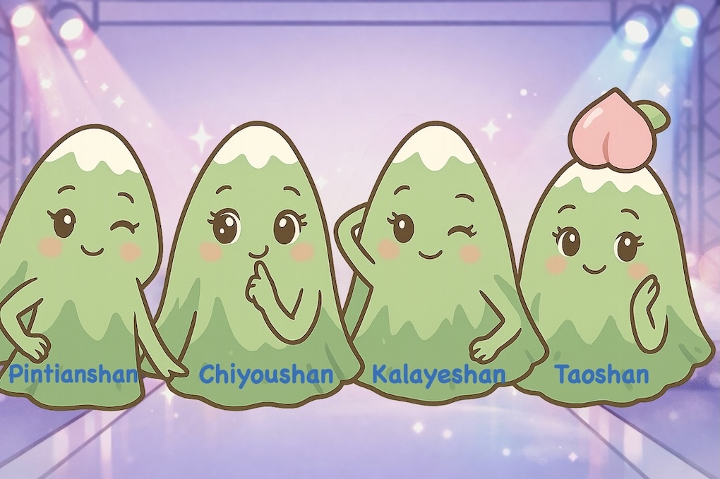
Also known as the Wuling Quadruple Mountains, these four peaks are famed for their graceful ridgelines and scenic charm — though one is more “lousy” than lovely.
All except Kalaye reward hikers with stunning summit views, making this group a popular introduction to Taiwan’s 100 Peaks.
- Taoshan 桃山 – 3,325m|Rank: #48
- The most graceful of the four, with soft, elegant ridgelines.
- Its peak resembles a ripe peach from afar — hence the name “Tao” (peach).
- Kalayeshan 喀拉業山 – 3,133m|Rank: #84
- The shortest and most remote of the Four Beauties.
- Despite its melodic name from the Atayal language, the trail remains entirely within dense forest and arrow bamboo zones, and the summit offers no view.
- Often jokingly counted among the “Four Bird Mountains” (四大鳥山) — peaks notorious for their lack of scenery and long, punishing return ascents that make hikers curse aloud.
- Chiyoushan 池有山 – 3,303m|Rank: #52
- Named for the several alpine ponds on its western side.
- Offers panoramic views from its broad summit.
- Pintianshan 品田山 – 3,524m|Rank: #24
- The highest and most rugged of the four.
- Famed for its steep cliffs — including the dramatic “Pintian Cliff” and the iconic “V-shaped Cliff”
- The highest headwater of the Tamsui River system.
🐦 Four Bird (四大鳥山)
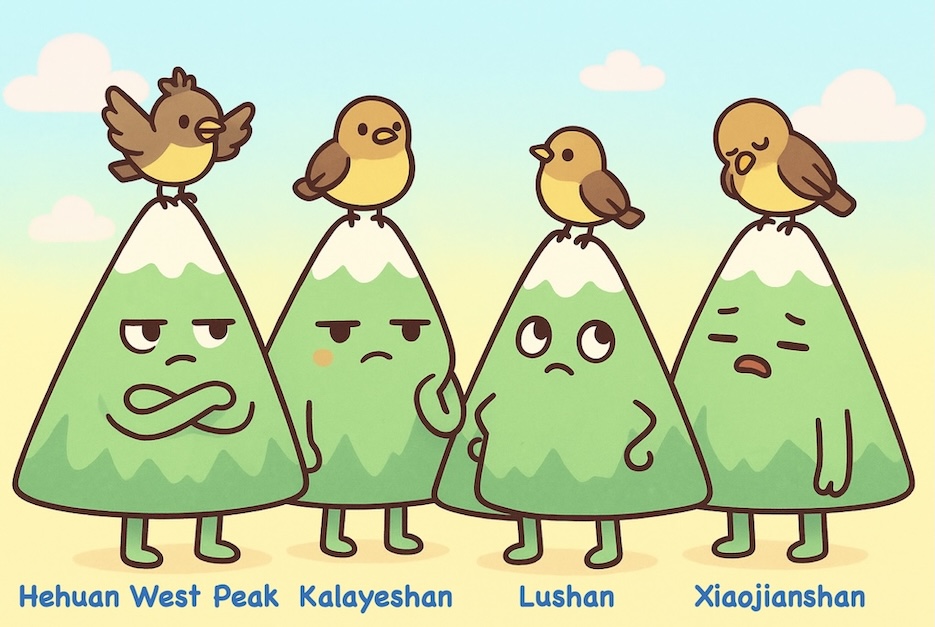
The Four Bird are notorious peaks dreaded more than desired — long, viewless hikes that drain your energy and patience.
Despite being relatively accessible, they leave many hikers cursing on the way back all thanks to their soul-crushing return ascents — hence the nickname.
Note: In Taiwanese slang, “niao” (鳥, literally “bird”) is a pejorative word used to express frustration, disappointment, or something downright awful — much like the experience of climbing these peaks. Hikers often finish by shouting “真鳥!” (Really bird! What a pain!) — a raw outburst of pure exhaustion and frustration.
- Hehuan West Peak 合歡西峰 – 3,145m|Rank: #82
- The most scenic of the four, featuring grassy slopes and wide-open views.
- Usually reached via Hehuan North Peak in an 8–12 hour round trip.
- Kalayeshan 喀拉業山 – 3,133m|Rank: #84
- Its “bird” reputation comes from the entire route being forest-bound and viewless, with a brutal return climb back over Taoshan.
- Also one of the Four Beauties — see more in the Wuling Four Beauties section.
- Lushan 鹿山 – 2,981m|Rank: #100
- The lowest peak on the Baiyue list, but a serious test of endurance.
- A 10–14 hour round trip from Yuanfeng Cabin with steep return climbs and no summit view.
- Xiaojianshan 小劍山 – 3,253m|Rank: #64
- A sword-like peak with minimal summit views.
- A rugged, complex, and viewless 10–14 hour day trip from Youpolan Cabin or campsite — usually climbed for the sake of completion rather than enjoyment.
🌶️ Four Spicy (中橫四辣)
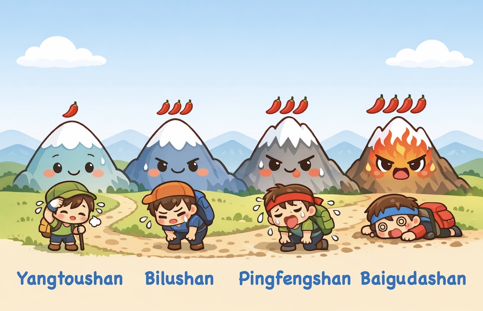
This famously punishing set of peaks rises along Taiwan’s Central Cross-Island Highway — hence the name “Four Spicy Peaks of the Central Cross-Island Highway (中橫四辣).”
Known for brutal climbs and relentless elevation gain, each peak is ranked on a playful “spice scale”, from mild to extra hot, reflecting its level of physical and mental challenge.
Note: The term “spicy” (辣) is a humorous metaphor used by local hikers to describe difficulty — the hotter the spice, the harder the climb.
- Yangtoushan 羊頭山 – 3,035m|Rank: #96 — Mild (小辣)
- Named for its supposed resemblance to a ram’s head.
- A deceptively short 4.1km climb with over 1,000 meters elevation gain, taking 8–10 hours round-trip.
- Bilushan 畢祿山 – 3,371m|Rank: #39 — Medium (中辣)
- Requires an 8.4 km approach along 820 Forest Road just to reach the trailhead.
- From the trailhead, a 2 km ascent gains 800 meters — with slopes up to 70° and a near-vertical 5-meter rock wall — making the 20+ km round trip a 12+ hour challenge, even with a light pack.
- Can be linked with Yantoushan in the Biyang Traverse (畢羊縱走), crossing the Sawtooth Ridge (鋸齒連峰) with a night at Judong Cabin — though if there’s no water, hikers must carry it from 820 Forest Road 8.4K and carry it all the way up, adding an extra layer of spice.
- Pingfengshan 屏風山 – 3,250m|Rank: #65 — Hot (大辣)
- Named for its screen-like ridgeline appearance.
- Once considered the spiciest of the Four, it now ranks second thanks to a new route — but remains a tough 2–3 day hike.
- Offers the least scenery of the Four Spicy peaks, with almost no views along the way.
- Baigudashan 白姑大山 – 3,341m|Rank: #45 — Extra Hot (特辣)
- A legendary endurance test featuring endless steep slopes, stone waterfalls, fallen trees, dense bamboo thickets, and over 1,300 m of elevation gain and loss.
- Usually a 2–3 day hike, it rewards with stunning hemlock groves and expansive views.
- For years, hikers had to haul all their drinking water or filter brown water from ponds and swamps — but recent discoveries of fresh flowing sources have been a game-changer.
🚧 Four Obstacles (四大障礙)
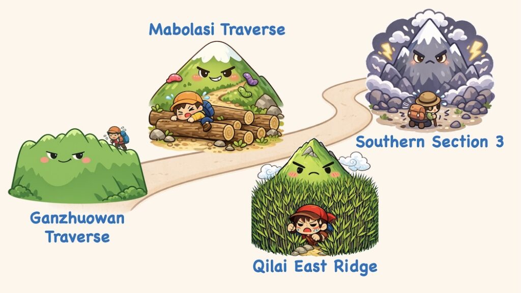
These four routes are Taiwan’s most demanding multi-day mountain traverses — epic in scale, brutal in terrain, and unforgiving in distance.
They’re considered the ultimate challenge of experienced Taiwanese hikers, pushing physical, mental, and technical limits.
- Ganzhuowan Traverse 干卓萬群峰 – 85km|3–5 days
- No mountain huts along the route — tents are required.
- Features the notorious “18 Consecutive Peaks” — a relentless series of steep ascents, cliffside traverses, dense bamboo thickets, and final river crossings.
- The trail is lined with sharp juniper and other thorny vegetation.
- During dry seasons, the lack of water sources means hikers must carry their own — significantly increasing the challenge.
- Mabolasi Traverse 馬博拉斯橫斷 – 96.3km|6–8 days
- A high, rugged traverse with heart-stopping cliffs and brutal elevation changes — despite having basic cabins along the route, it still takes 6–8 days to complete.
- The trail is known for its fallen trees, dense bamboo grass, moss, ferns, lichen, and bloodthirsty leeches.
- Before the finish line, hikers must endure the soul-crushing Zhongping Forest Road — a notoriously long, humid, mossy, leech-infested trudge to the exit ( the leeches here are actually colorful).
- Qilai East Ridge 奇萊東稜 – 56km|4–6 days
- Day one features 1,000+ meters of ascent; the final day ends with a brutal 2,000-meter descent.
- The most punishing section is the infamous “sea of bamboo grass” — a dense stretch that feels like swimming through endless thickets. On rainy days, it turns into a true nightmare.
- The leech-infested Yanhai Forest Road during the rainy season adds to the dread.
- Despite being shorter in duration than other Four Great Obstacles, many consider it the most difficult — with some declaring, “Once in a lifetime is more than enough.”
- Southern Section 3 南三段 – 100km|10 days (6–7 for experts)
- Welcome to Taiwan’s “final boss” — the most feared and respected of all multi-day traverses.
- This is Taiwan’s most remote, wild, and complex trail. It weaves through the untamed core of the Central Mountain Range, with over 8,900 meters of elevation gain and nearly 8,000 meters of descent.
- It’s notorious for its rugged peaks, isolated ridgelines, and mind-bending terrain.
- Veteran hikers call it the “ultimate traverse” — and warn: “If you’re not fully prepared, don’t even try.”
💵 Find These Peaks in Your Wallet
Did you know some of Taiwan’s 100 Peaks aren’t just found in the mountains — they also show up in your wallet?
Next time you’re hiking one of these giants, bring a few bills and match them with the real thing on the trail:
🟤 NT$500 bill → Dabajianshan (大霸尖山)
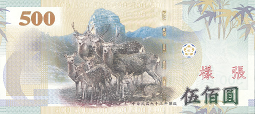
🔵 NT$1,000 bill → Yushan Main Peak (玉山主峰)

🟣 NT$2,000 bill → Nanhudashan (南湖大山)

So when planning a hike in Taiwan, don’t forget your pack, your permits — and maybe a banknote or two.
Because your next summit might already be in your wallet.