Learn the origins of the Baiyue, trail difficulty levels, and key resources for your next mountain adventure.
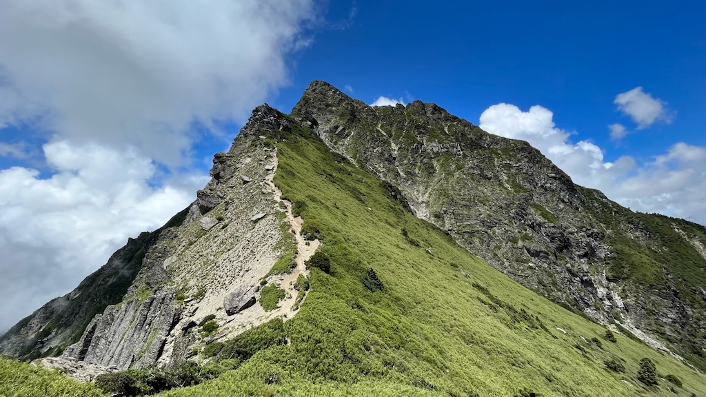
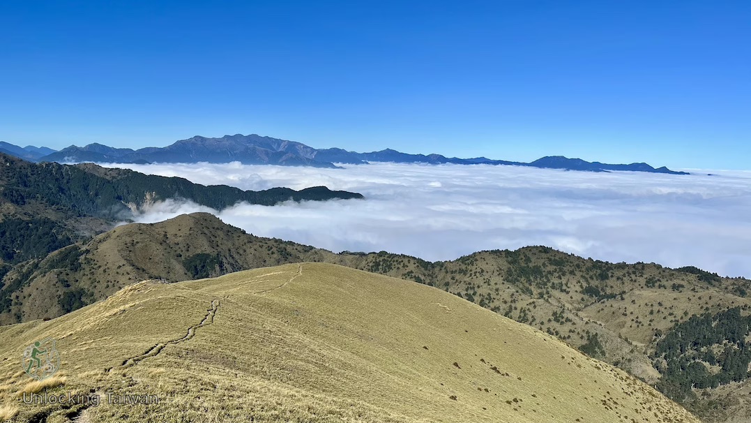
Taiwan sits on the boundary between the Eurasian and Philippine Sea tectonic plates, creating one of the world’s most dramatic mountain-building zones. As a result, nearly 70% of the island is covered in mountains. No matter where you are in Taiwan — city, coast, or countryside — just look up, and you’ll see mountains framing the skyline.
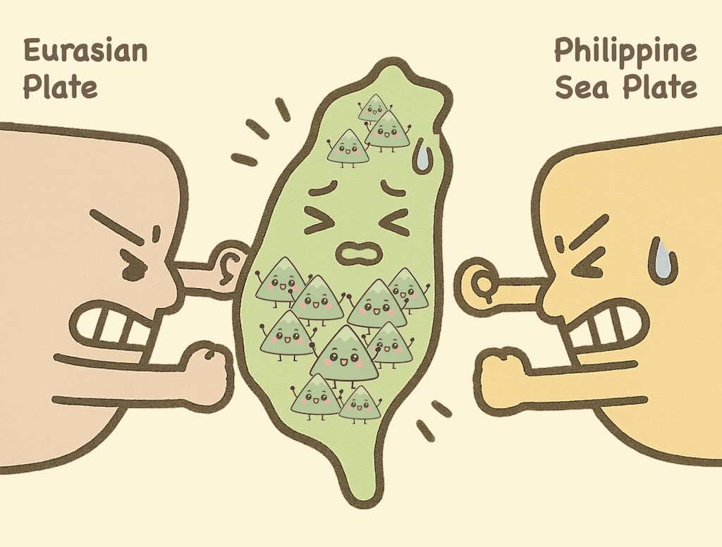
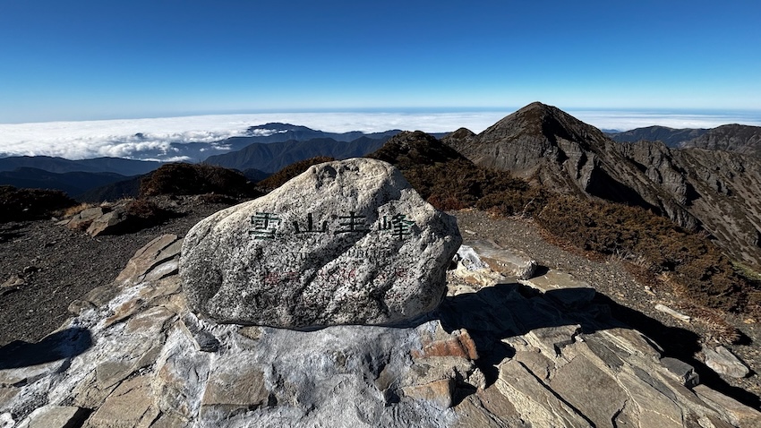
Among these mountains, 286 peaks soar above 3,000 meters. From these, a handpicked list of 100 was chosen to represent the very best of Taiwan’s alpine beauty. Known as the “Baiyue” (百岳) — literally “Hundred Mountains” — this collection represents Taiwan’s most iconic high-altitude hiking destinations. This list has soon become a legendary bucket list for serious hikers. For many Taiwanese adventurers, completing the full list — a feat called “Wan Bai” (完百) — is a lifelong dream and one of the ultimate goals in Taiwan’s hiking community.
What Are Taiwan’s 100 Peaks (Baiyue)?
The Baiyue list was created in 1972 by a group of experienced hikers who wanted to promote alpine hiking in Taiwan. They selected 100 iconic mountains that represent the very best of Taiwan’s high-mountain landscapes and rugged natural beauty.
Selection criteria included:
- Elevation above 3,000 meters
- Striking or unique appearance — rugged, dramatic, or beautiful
- Officially named summit with a triangulation point (used for topographic mapping)

Their goal was to promote hiking culture in Taiwan and foster a deeper connection between people and the island’s spectacular mountain wilderness.
Since its creation, the Baiyue list has become a legendary pursuit in Taiwan’s hiking community — and an increasingly popular challenge for foreign adventurers drawn to Taiwan’s soaring peaks

Two “Imposters” Under 3,000 Meters?
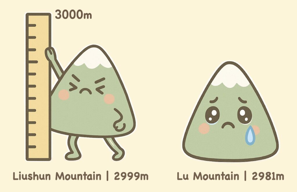
Although all Baiyue peaks were meant to be over 3,000 meters, two mountains were mistakenly included due to early measurement errors — and remain on the list to this day:
- Liushun Mountain (六順山) – 2,999 m
- Lu Mountain (鹿山) – 2,981 m
These so-called “imposters” are now part of Baiyue folklore — and still counted in every true Wan Bai achievement.
Where Are the 100 Peaks Located?
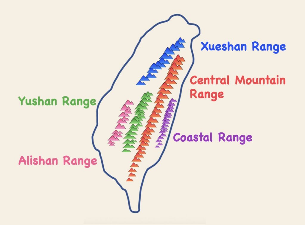
Taiwan’s 100 Peaks are distributed across three major mountain systems. Here’s a break down:
- Central Mountain Range: 69 peaks — Taiwan’s mountainous backbone
- Xueshan (Snow Mountain) Range: 19 peaks — including Taiwan’s second-highest summit
- Yushan (Jade Mountain) Range: 12 peaks — home to Taiwan’s highest mountain
- Alishan & Coastal Ranges: None (elevations below 3,000m threshold)
Many of the peaks are located within national parks, offering stunning vistas, challenging terrain, and incredible experience — but also requiring permits and physical preparation.
Essential Resources for 100 Peaks Planning
Taiwan’s 100 Peaks Hiking Spreadsheet
Want to know if a mountain you’ve hiked is part of the 100 Peaks? Or looking for route information and permit requirements to plan your next big adventure?
Check out this comprehensive, English-friendly spreadsheet compiled by a local hiking expert.
📘Route of the 100 Peaks of Taiwan – Baiyue Guide
It includes:
- The full Baiyue list and mapped hiking routes
- Elevation gain/loss
- Difficulty level and estimated hiking duration (in days)
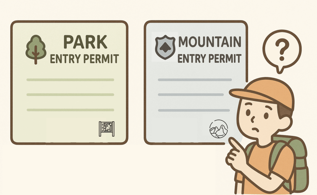
- Required permits (e.g. park or mountain entry permits)
- GPX tracks for navigation
A must-have resource for any hiker interested in exploring Taiwan’s high mountains.
Permit Resources
Most Taiwan 100 Peaks require advance permits due to their location within national parks, protected areas, or police-controlled mountain zones.
The official English platform for applications is:
👉 Hike Smart Taiwan – Your one-stop site for park entry permits
👉 Mountain Entry Permit Application – Required for police-regulated mountain zones
🛠 A step-by-step guide to applying for permits will be coming soon on Unlocking Taiwan.
Understanding Taiwan’s Mountain Difficulty Levels
You may come across two different systems for grading trail difficulty in Taiwan. The older A–E grading system, though officially retired, is still commonly used by local hikers. The newer official Grade 0–6 system was introduced in 2021 to provide a more standardized assessment. Both can help you gauge a trail’s difficulty and what to prepare.
Legacy System: Grade A–E Trail Classification
The above spreadsheet (Baiyue Guide) used an A–E grade to each mountain, based on a now-retired classification system once widely used in Taiwan. While officially discontinued in 2019, this grading system is still a go-to reference among local hikers and appears in some trail resources.
Here’s what each grade typically means:
Non-Winter Classifications:
- Grade A: General hiking trails (1-3 days).
Examples: Yushan Main Peak, Xueshan - Grade B: Intermediate traverses (4-5 days) or shorter routes with exposed or hazardous terrain.
Examples: Nanhu Peaks, Yushan North Peak, Qilai Main Peak - Grade C: Advanced multi-day hikes (5+ days) in remote terrain
Examples: Guanshan, Beinan Zhushan - Grade C+: Advanced routes with rappelling/climbing sections.
Examples: Yushan East Peak, Zhongyangjian
Winter Additions: (not shown on the above spreadsheet)
- Grade D: Snow-covered routes open with restrictions during winter.
- Grade E: Routes closed during winter for safety.
Note: Winter conditions can elevate any route’s difficulty level significantly.
New System: Grade 0–6 Trail Classification
In 2021, Taiwan’s national parks introduced a standardized trail classification system ranging from Grade 0 to Grade 6, designed to help hikers of all levels assess trail difficulty, accessibility, and the gear needed for safe hiking
The following official table, developed by Taiwan’s Ministry of the Interior, outlines the Grade 0–6 system with trail descriptions, recommended suitability, and essential equipment for each level:
Difficulty Level | Description | Suitability | Recommended Equipment |
Level 0 | The trail is flat and has good facilities. The slope is gentle and suitable for wheelchairs and children’s strollers. | Suitable for all ages, wheelchair users, and children’s strollers. | Water, hiking snacks, rain gear, mobile phone. |
Level 1 | The trail is well maintained with facilities in good conditions, and it features guiding resources and a gentle slope. A normal itinerary takes half a day to one day to complete. | Walkers. | Water, hiking snacks, rain gear, mobile phone. |
Level 2 | The trail is well maintained with facilities in good conditions, but the slope has slight undulations, and there are potential risks due to unpredictable weather. A normal itinerary can be completed within one day. | People with average to good physical fitness. | Water, hiking snacks, rain gear, mobile phone, warm clothing, backpack. |
Level 3 | The trail is located in a relatively remote mountainous area. The path is clearly formed but some slopes are very steep. There are potential risks due to unpredictable weather. A normal itinerary can be completed in one to three days. | People with good physical fitness who have the ability to read basic maps, carry heavy loads while walking, assess risks, and respond to emergencies. | Refer to Table 2 to bring the necessary camping or forced bivouac equipment based on your itinerary |
Level 4 | The trail is located in a remote mountainous area. The path is formed, but parts of the terrain are rugged, and there are potential risks due to unpredictable weather. A normal itinerary can be completed in three to five days, or within three days if the trail features challenging terrain. | People with good physical fitness who have the ability to read maps, carry heavy loads while walking, survive in the wilderness, assess risks, and respond to emergencies. | Refer to Table 2 to bring the necessary camping and related technical/climbing equipment based on your itinerary. |
Level 5 | The trail is located in a remote mountainous area, and the path is relatively unformed. There are potential high risks due to rugged terrain and unpredictable weather. A normal itinerary takes three to five or more days to complete, and preparations for challenging terrain must be made. | People with excellent physical fitness who have the ability to read maps, carry heavy loads while walking, survive in the wilderness, assess risks, and respond to emergencies. | Refer to Table 2 to bring the necessary camping and related technical/climbing equipment based on your itinerary. |
Level 6 | 1. A Grade 3 to 5 trail covered in snow (ice). 2. Special routes, such as routes that are not established, unformed mountainous tracks without defined roadbeds or paths, remnants of ancient trails, or trails that require specialized exploration or climbing skills. | People familiar with snow mountaineering or those who have the necessary technical/climbing skills. | Refer to Table 2 to bring the necessary camping and related technical/climbing equipment based on your itinerary. |
Source: Taiwan National Park Trail Classification System (PDF)
⚠️Important: Always check trail conditions and regulations in advance — especially for Grade 3 and above, where permits, or seasonal closures may apply.
How to Check a Trail’s Difficulty Grade (Level 0–6)
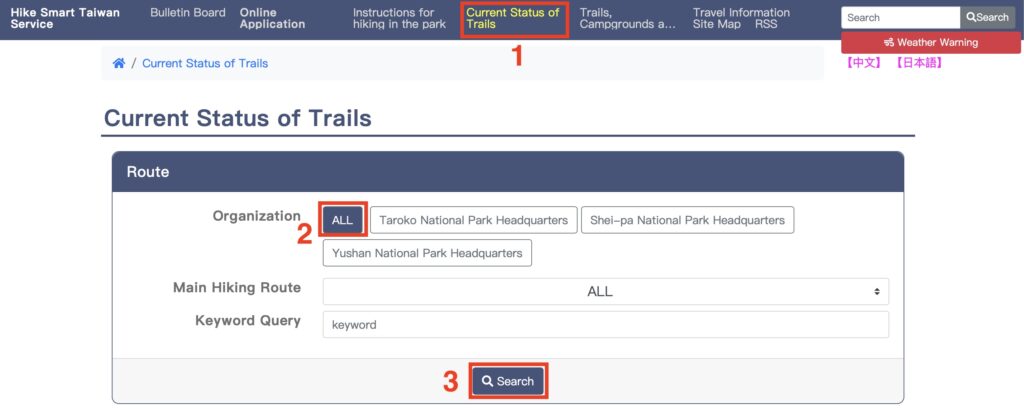
Want to find out the difficulty level of a specific Baiyue trail? Follow these steps:
- Go to Hike Smart Taiwan, the official English-language platform for hiking information and permit applications.
- Click on “Current Status of Trail” in the main menu.
- If you’re unsure which national park your trail belongs to, select “All” from the drop-down menu, then click Search.
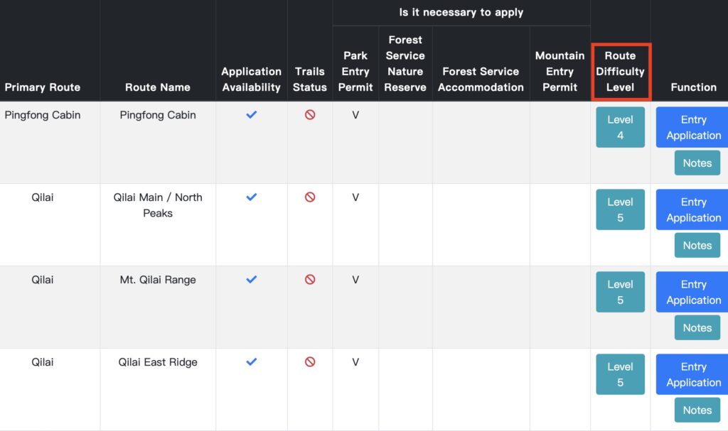
- Scroll down or search for your target route — for example, Xue Mountain trail or Yushan Trail.
- Each trail listing will show its Grade 0–6 classification, current status (open/closed), and permit requirements.
Even though this newer system is more detailed and standardized, many local hikers still refer to the older A–E grading system — especially when discussing the 100 Peaks (Baiyue).
When in doubt, cross-reference both systems and always plan your hike according to your experience, the latest trail conditions, and weather forecasts.
💡 Tip: Some Baiyue trails are still widely referred to by their old A–E grade, even in guidebooks or forums. Knowing both systems helps you navigate both official info and local advice.
Whether you’re gearing up for your first Baiyue summit or inching toward your 100th, these mountains offer a lifetime of adventure — and a window into Taiwan’s wildest, most breathtaking terrain.
Come to experience Taiwan’s wild heart.
👉 Curious about the secret codes behind Taiwan’s 100 Peaks, like “Five Greats,” “Three Spires,” and “Four Birds”?
Don’t miss the next article in our series, where we break down the nicknames and mountain categories hidden within the Baiyue list.