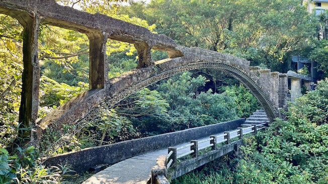
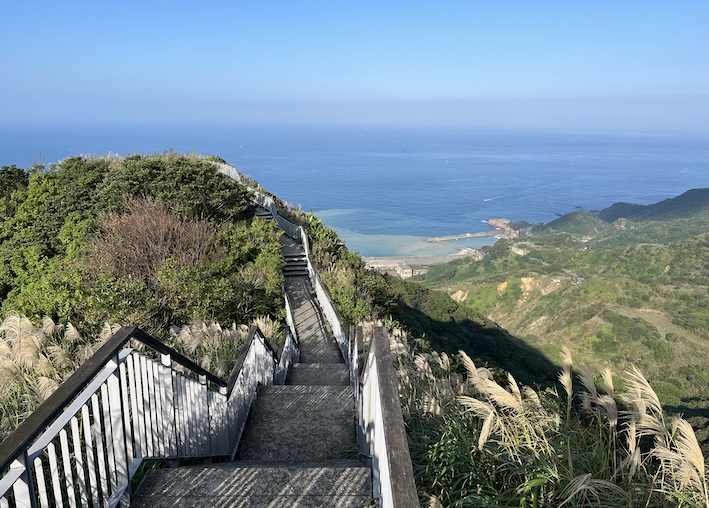
One of northern Taiwan’s most rewarding ridge hikes—combining mountain views, coastal scenery, and mining heritage in a single day.
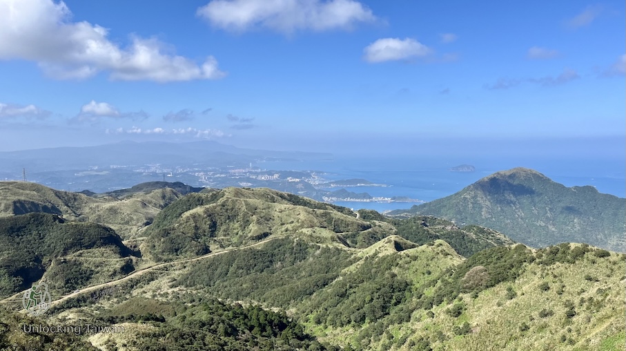
Overview
Most visitors climb Teapot Mountain, snap a few photos, then head back down.
What they don’t realize is that they’re only seeing the beginning.
Continue beyond the summit, and this hike unfolds into one of northern Taiwan’s most diverse adventures—three panoramic peaks, one of Taiwan’s most famous coastal ridgelines, a striking geological park where rows of giant stone blocks overlook the Northeast Coast, and atmospheric Japanese-era mining ruins—all in a single day.
The route follows Teapot Ridge (茶壺山稜), better known locally as Gold Ridgeline No. 3 (黃金三稜), as it traverses from Teapot Mountain to Banping Mountain. From there, hikers can optionally continue to Canguangliao Mountain (燦光寮山)—the highest peak in the Keelung Volcanic Group—before descending past Benshan Geological Park (本山地質公園) and the Jinguashi Shinto Shrine (黃金神社) to finish at the Gold Museum.
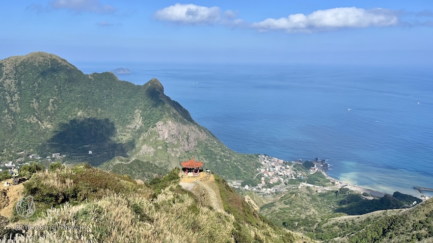
Unlike the more technical Stegosaurus Ridge, this route delivers many of the same rewards—dramatic ridge walking, hands-on scrambling, and sweeping mountain-and-ocean views—but with easier logistics and a lower technical difficulty.
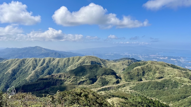
💡 Unlocking Taiwan Tip: Many visitors confuse Teapot Mountain with Teapot Ridge. Teapot Mountain is a single summit, while Teapot Ridge refers to the ridgeline connecting Teapot Mountain and Banping Mountain—the section that gives this hike its adventurous character.
On a single hike, you’ll experience:
- Teapot Mountain, one of Taiwan’s most iconic coastal peaks
- Teapot Ridge (Gold Ridgeline No. 3), one of Jinguashi’s famous Golden Ten Ridgelines
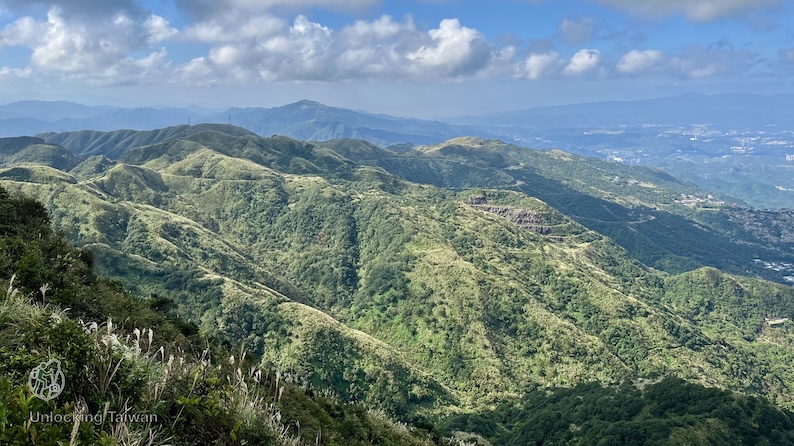
- Banping Mountain’s sweeping grassy summit
- An optional extension to Canguangliao Mountain
- Benshan Geological Park, where giant stone blocks overlook Taiwan’s Northeast Coast
- The atmospheric Gold Shrine Ruins from Taiwan’s mining era
If you’re looking for:
- one of the best ridge hikes near Taipei
- a more rewarding alternative to hiking only Teapot Mountain
- a hike combining mountain and ocean views
- an adventurous route accessible by public transport
- an introduction to Taiwan’s famous Golden Ten Ridgelines
This is one of the best day hikes in northern Taiwan.
💡 Disclosure: This article contains affiliate links. If you book through them, I may earn a small commission at no extra cost to you. Thanks for supporting Unlocking Taiwan!
Trail at a Glance
- Difficulty: Moderate
- Distance: Approx. 8 km (point-to-point)
- Duration: 4 – 6 Hours
- Elevation Gain: Approx. 565 m (1,854 ft)
- Permit Required: No
- Best Season: Autumn (for the silvergrass) or Spring
Why Hike This Trail?
The highlight of this route is Teapot Ridge (Gold Ridgeline No. 3), one of the most famous routes within Jinguashi’s legendary Golden Ten Ridgelines (黃金十稜).
The ridgeline combines dramatic coastal scenery, rugged terrain, historic mining sites, and constantly changing landscapes. This is not simply a hike to Teapot Mountain. It’s a journey across one of northern Taiwan’s most distinctive mountain landscapes.
In a single day, you’ll be able to:
- Summit three distinctive mountains
- Experience one of Taiwan’s best-known ridge traverses
- Enjoy panoramic views of both the mountains and the Pacific Ocean
- Visit historical mining sites dating back to the Japanese colonial era
- Complete the entire hike using public transportation
If you’re ready to move beyond beginner-friendly trails but aren’t looking for an extreme mountaineering route, this is one of the best next-step hikes in northern Taiwan.
Trail Highlights
Teapot Mountain | 茶壺山 (602 m)
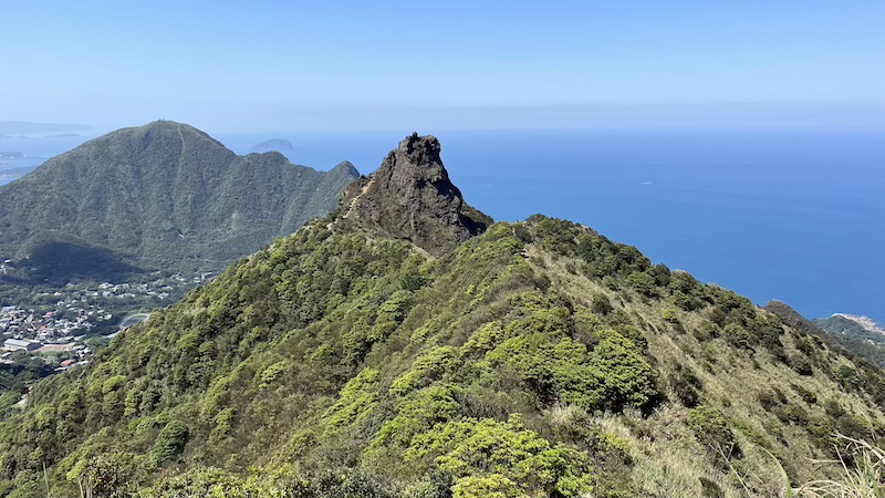
Teapot Mountain is undoubtedly the most recognizable peak in the Jiufen–Jinguashi area.
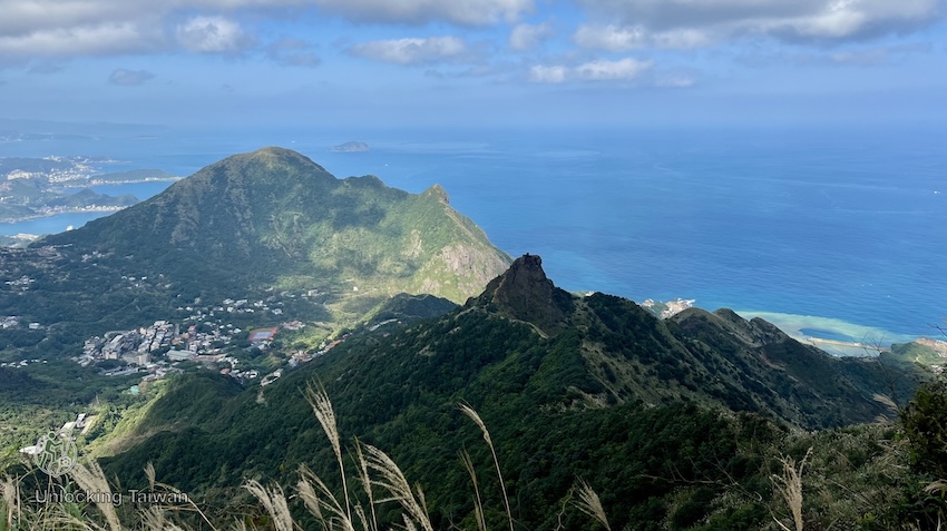
Named after its distinctive teapot-shaped rock formation, it’s famous for its dramatic summit overlooking the Pacific Ocean and the colorful Yin-Yang Sea below.
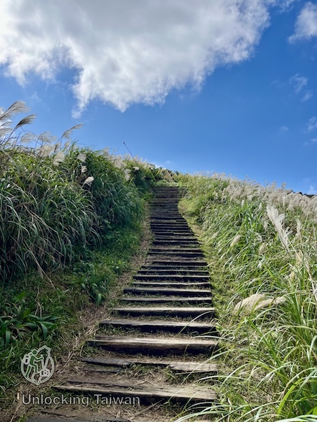
Most of the climb follows well-maintained stone steps, with only a short rope-assisted scramble required near the summit.
For many visitors, this is where the hike ends.
For experienced hikers, however, it’s where the adventure begins.
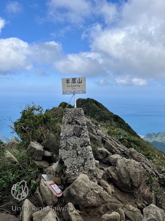
Banping Mountain | 半屏山 (714 m)
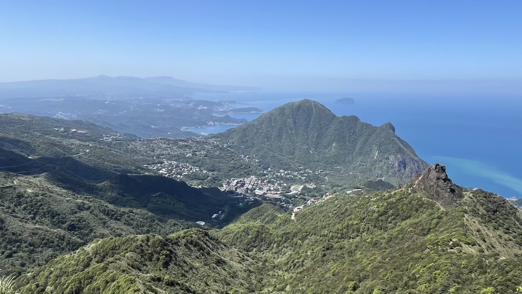
Banping Mountain feels surprisingly alpine despite its relatively modest elevation.
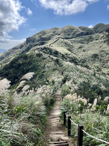
Its broad grassy ridgeline, rolling hills, and uninterrupted coastal views create a landscape unlike anywhere else near Taipei.
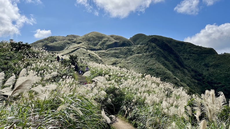
During autumn, the surrounding hillsides become covered in silvergrass, creating one of the most beautiful seasonal displays in northern Taiwan.
Canguangliao Mountain | 燦光寮山 (738 m)
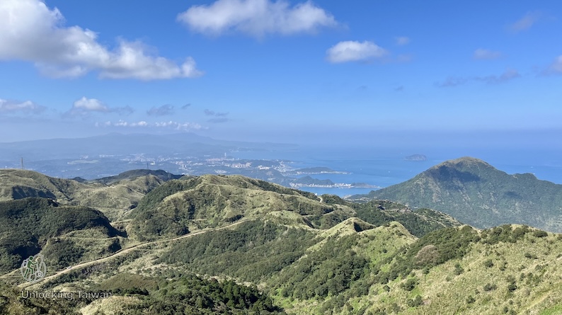
If you still have energy after Banping Mountain, adding Canguangliao Mountain is well worth the extra effort.
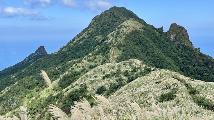
As the highest peak in the Keelung Volcanic Group, it offers one of the best panoramic viewpoints on the entire route.
The climb from Grass Mountain Military Road trailhead takes only about 20–30 minutes, making it a great extension to an already rewarding hike.
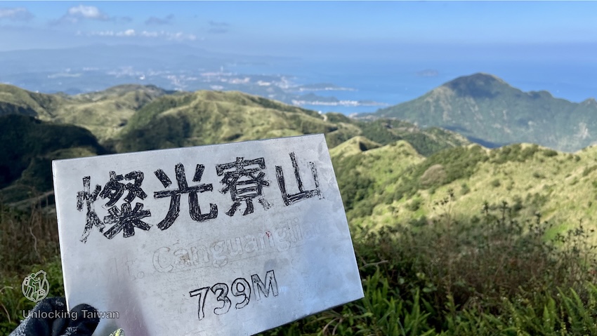
From the summit, you’ll be treated to sweeping views back across Banping Mountain, Teapot Mountain, Keelung Mountain, and the ridgelines you’ve just traversed.
Visit in November or early December, and the surrounding grasslands become covered in shimmering silvergrass, creating one of the most photogenic scenes in the region.
Benshan Geological Park | 本山地質公園
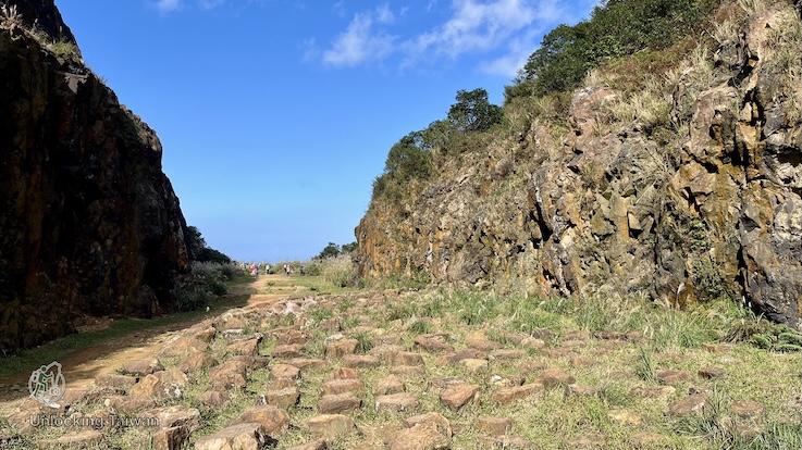
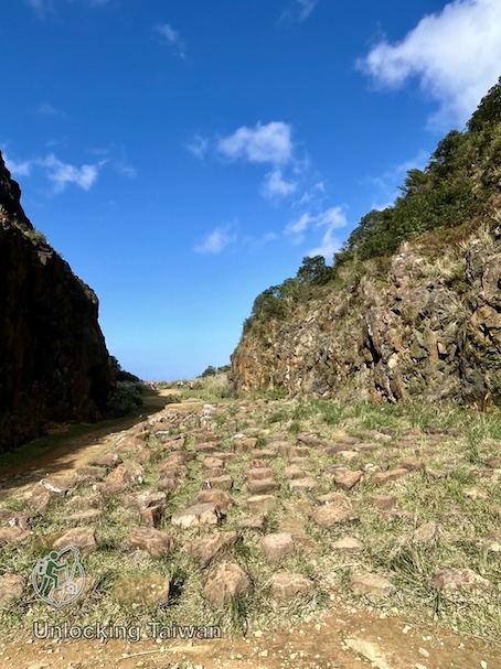
Located near the end of the hike, Benshan Geological Park offers a completely different landscape from the surrounding ridgelines.
The area was once one of Jinguashi’s most important gold-mining zones. Today, rows of giant stone blocks spread across an open grassy plateau, creating a dramatic and unusual landscape unlike anywhere else along the route.
💡 Unlocking Taiwan Tip: The Mystery Behind the Stone Formations
The rows of giant stones may look like a natural geological formation, but they were actually rearranged by machinery to create an outdoor theater for U-Theatre (優人神鼓), a Taiwanese performance group.
The project took place in the former Benshan mining area, once one of Jinguashi’s most important gold-mining zones. The result is a landscape that looks ancient and mysterious—but is, in fact, a relatively recent creation.
Jinguashi Shinto Shrine (Gold Shrine) | 黃金神社
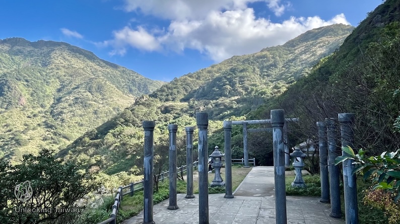
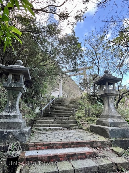
After descending from Canguangliao Mountain, the trail passes the atmospheric ruins of the former Jinguashi Shinto Shrine (also called Gold Shrine), one of the best-preserved reminders of Taiwan’s Japanese mining era.
Built during the Japanese colonial era, the shrine served the mining community of Jinguashi, once one of Taiwan’s richest gold-producing regions.
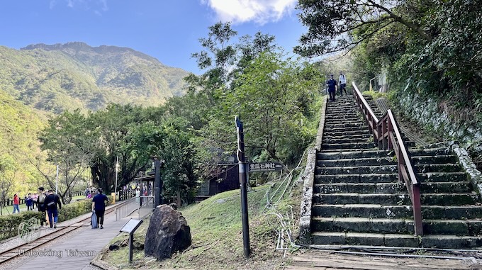
Today, you’ll still find original stone lanterns, torii gate remains, weathered stone pillars, and long flights of moss-covered steps scattered across the hillside.
Combined with sweeping views of Jinguashi, Keelung Mountain, and Teapot Mountain, the shrine ruins are one of the most atmospheric and photogenic stops along the entire hike.
How to Get to Teapot Mountain Trailhead
Most hikers begin at the Teapot Mountain Trailhead near Cyuanji Temple (勸濟堂).
The trailhead can also be accessed from the Gold Museum area.
By Public Transport
Planning to hike only Teapot Mountain? Get off at Cyuanji Temple.
If you’re completing the full Teapot Mountain–Banping Mountain–Canguangliao Mountain traverse, you can finish at the Gold Museum and take a bus back without backtracking.
To the Teapot Mountain Trailhead
The trailhead can be reached from either of the following bus stops:
- Cyuanji Temple (勸濟堂)
✔ The closest bus stop to the trailhead
✔ About a 5 minute walk to the trailhead. - Jinguashi | Gold Museum (金瓜石 | 黃金博物館)
✔ About a 10 minute walk to the trailhead
Departure Point | Bus No. | Get off |
Taipei (MRT Zhongxiao Fuxing Station, Exit 2) | Cyuanji Temple (勸濟堂) | |
Taipei (MRT Fuzhong Station / Banqiao Bus Station / MRT Ximen Station / MRT Beimen Station) | Taiwan Tourist Shuttle – Jiufen Jinguashi Route (No. 965) | Jinguashi | Gold Museum (金瓜石 | 黃金博物館) |
Keelung Train Station (Bus stop: Keelung Transit Station 基隆轉運站) | Bus 788 | Jinguashi | Gold Museum (金瓜石 | 黃金博物館) |
Ruifang Train Station (Bus stop: Resident Square 區民廣場) | Jinguashi | Gold Museum (金瓜石 | 黃金博物館) | |
Cyuanji Temple (勸濟堂) |
Return
After completing the hike, most hikers catch a bus from the Gold Museum.
If you parked at Cyuanji Temple, simply walk about 10 minutes back to the parking lot before driving away.
By Private Charter (Best for Families & Groups)
Public transport works well — but if you want flexibility and comfort, a private charter is the easiest way to explore this area in one day.
If you’re traveling with kids, elderly parents, or simply don’t want to deal with bus transfers and tight schedules, a private car charter makes the day significantly smoother.
Instead of navigating multiple buses, you can turn this into a relaxed Northeast Coast day trip and combine:
- Jiufen Old Street
- Golden Waterfall
- Baoshi Mountain Trail
- Other Northeast Coast attractions
It’s especially helpful if:
– You’re short on time
– You’re visiting Taiwan for the first time
– You prefer flexibility over fixed bus timetable
👉 Check availability & prices here:
- KKDay option – Taipei ↔ Jiufen / Jinguashi / North Coast (Multi-language driver available)
- Klook Option – Private Shuttle Transfer Between Taipei and Jiufen or Shifen
By Car/Scooter
- Navigation: Cyuanji Temple Parking Lot (勸濟堂停車場)
- Parking:
- Weekdays: NT$100 per entry
- Weekends: NT$200 per entry
- No temporary parking allowed near the trailhead.
- Logistics: can simply walk about 10 minutes back to the Cyuanji Temple parking lot after completing the hike.
Hiking Information
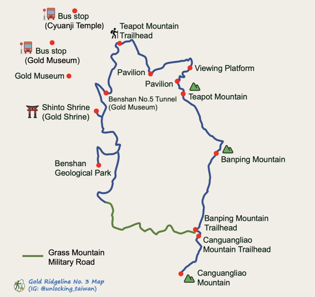
- Route: Cyuanji Temple (勸濟堂) → Teapot Mountain (茶壺山) → Banping Mountain (半屏山) → Canguangliao Mountain (燦光寮山) → Grass Mountain Military Road → Jinguashi Shinto Shrine / Gold Shrine (黃金神社) → Benshan Geological Park (本山地質公園) → Jinguashi Shinto Shrine Trailhead / Benshan No. 5 Tunnel (本山五坑)
💡 Note: After Canguangliao Mountain, the trail follows Grass Mountain Military Road (草山戰備道) before descending past the Gold Shrine Ruins and Benshan Geological Park to the Gold Museum. - Distance: 8 km / 4.97 miles (point-to-point)
- Difficulty: Moderate
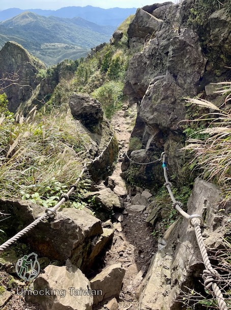
- Trail type: Stone steps, dirt trails, exposed ridgelines, and several rope-assisted scrambling sections.
- Permit: No permit required.
- Best season:
- Autumn/Winter: Perfect for cool weather and seeing the hillsides covered in blooming silvergrass.
- Spring/Summer: Great for clear ocean views and catching the coastal breeze (but start early to beat the midday heat!).
- Suggested Time: 4 – 6 hours, depending on breaks.
- My Time Log:
- 09:30 Teapot MountainTrailhead
- 10:25 Teapot Mountain (15-min rest)
- 11:00 V-shaped Cliff
- 11:10 Banping Mountain (15-min rest)
- 11:46 Banping Mountain Trailhead
- 11:50 Canguangliao Mountain Trailhead
- 12:05 Canguangliao Mountain (5-min rest)
- 12:28 Canguangliao Mountain Trailhead (10-min rest)
- 12:38 Grass Mountain Military Road
- 13:13 Benshan Geological Park (15-min rest)
- 13:50 Gold Shrine Ruins
- 14:05 Gold Shrine Trailhead / Gold Museum
- Note:
- As a reference, I completed the Tokyo marathon in 6 hours. Your timing may vary based on fitness level and rest time.
GPX Track Download
- Recorded on: December 16, 2025.
- Download GPX track (English waypoints included) of Gold Ridgeline No.3: Google Drive | Alltrails.
Weather Forecast
If it’s raining in Jiufen, there’s a high chance of rain in nearby Ruifang.
- Central Weather Administration website: Keelung Mountain (Chilungshan).
- Live webcam: Check the current weather conditions at Jiufen Old Street
Things to Know Before You Go
- Best Time to Visit: Spring and autumn offer the most comfortable hiking conditions. Visit from November to mid-December to see the surrounding hillsides covered in blooming silvergrass.
- Restrooms: Public restrooms are available at Cyuanji Temple and the Gold Museum. A portable toilet is also available near Chaobao Pavilion (朝寶亭). There are no restrooms along the ridgeline.
- Sun Exposure: There is very little shade along the entire ridgeline. During summer, you’ll spend several hours hiking under direct sunlight. Bring plenty of water, wear sun protection, and start early in summer.
- Weather:
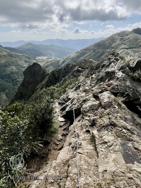
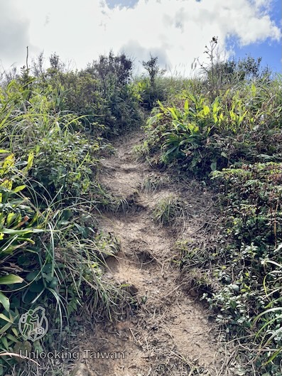
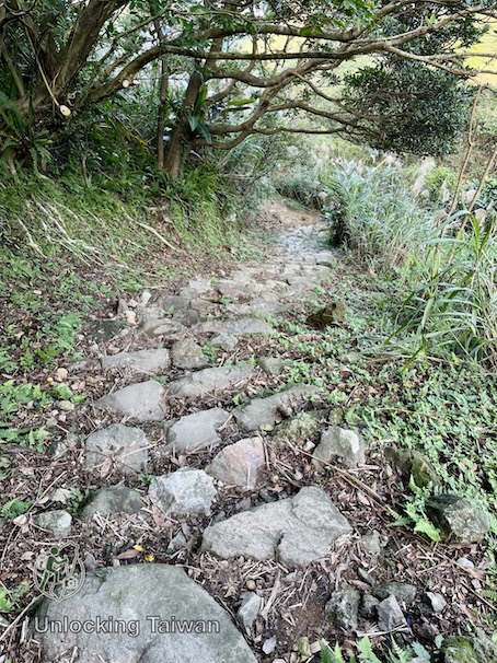
- Avoid hiking during rain or immediately afterward. The section between Teapot Mountain and Banping Mountain includes muddy, slippery sections and rough, rocky terrain with uneven footing, making the traverse significantly more hazardous when wet.
- Strong northeast monsoon winds can make the exposed sections around Teapot Mountain more challenging, especially on the summit and narrow ridgelines.
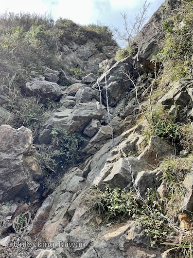
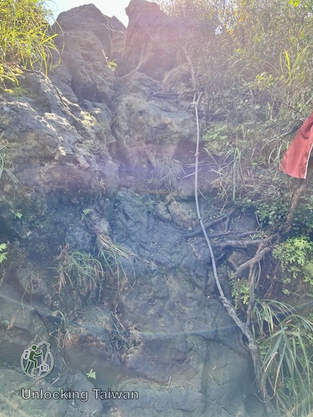
- Gloves: Several short scrambling sections are assisted by fixed ropes. While they’re not technically difficult, a lightweight pair of gloves will protect your hands and make the climb more comfortable.
💡 Unlocking Taiwan Tip: Teapot Mountain’s caves are part of Jinguashi’s former mining landscape. Past accidents occurred around abandoned ventilation shafts inside the caves, which is why these openings have been secured today. The caves are an interesting reminder of Jinguashi’s mining history, but they remain a natural rock environment—take your time and prioritize safety.
In Pictures & Video
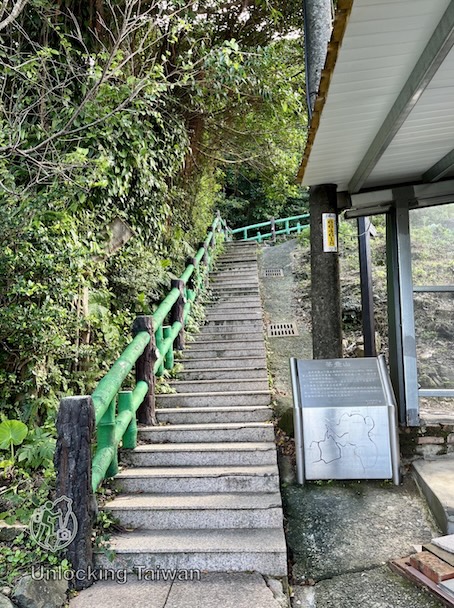
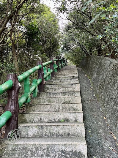
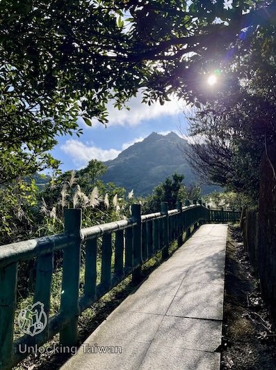
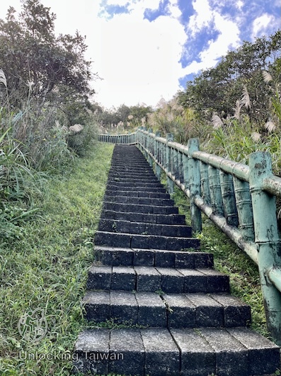
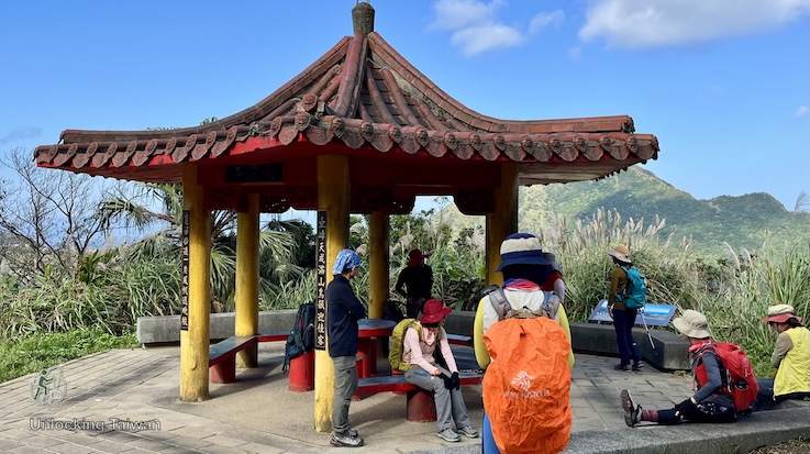
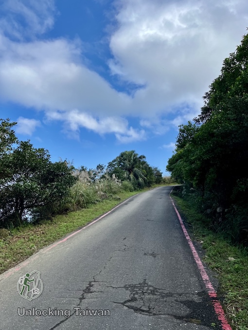
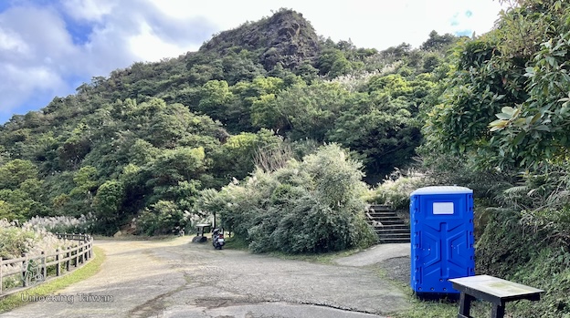
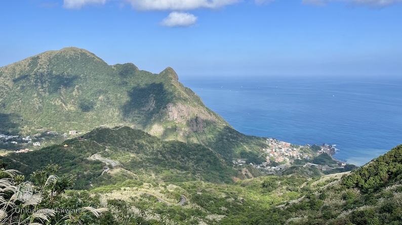
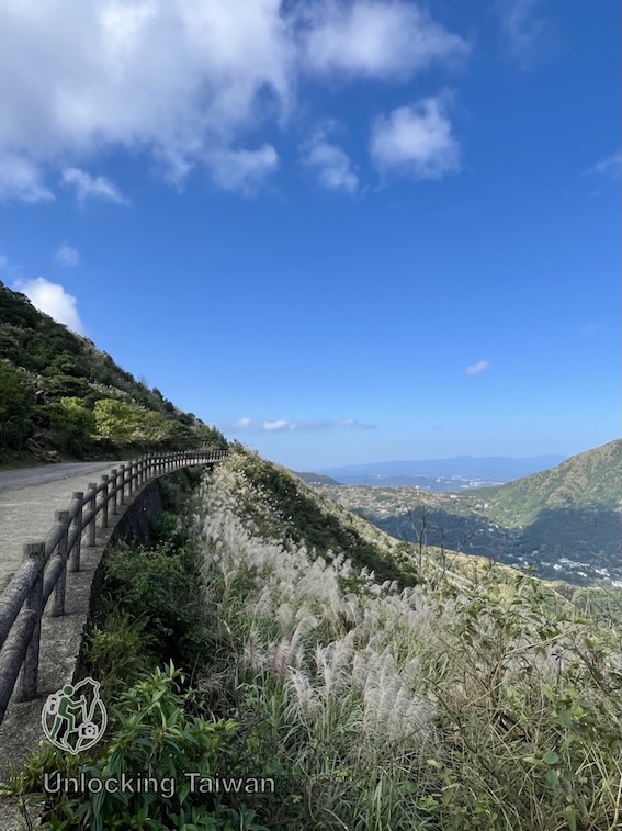
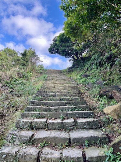
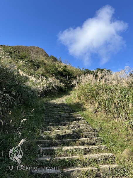
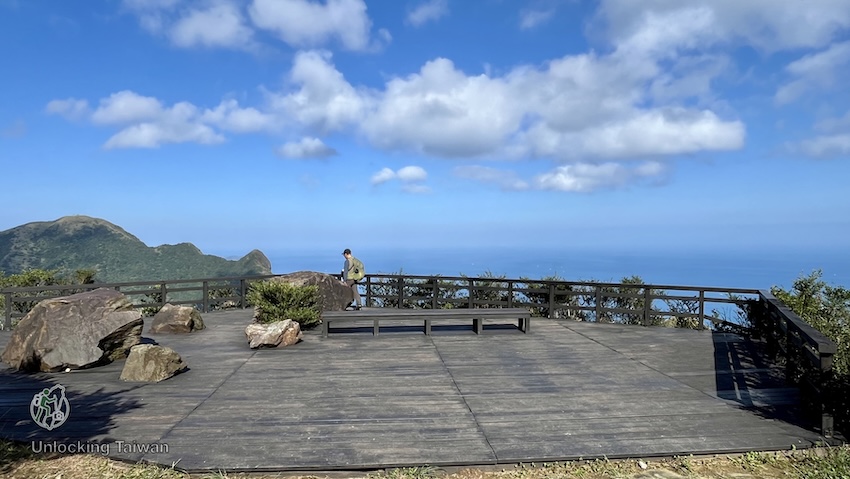
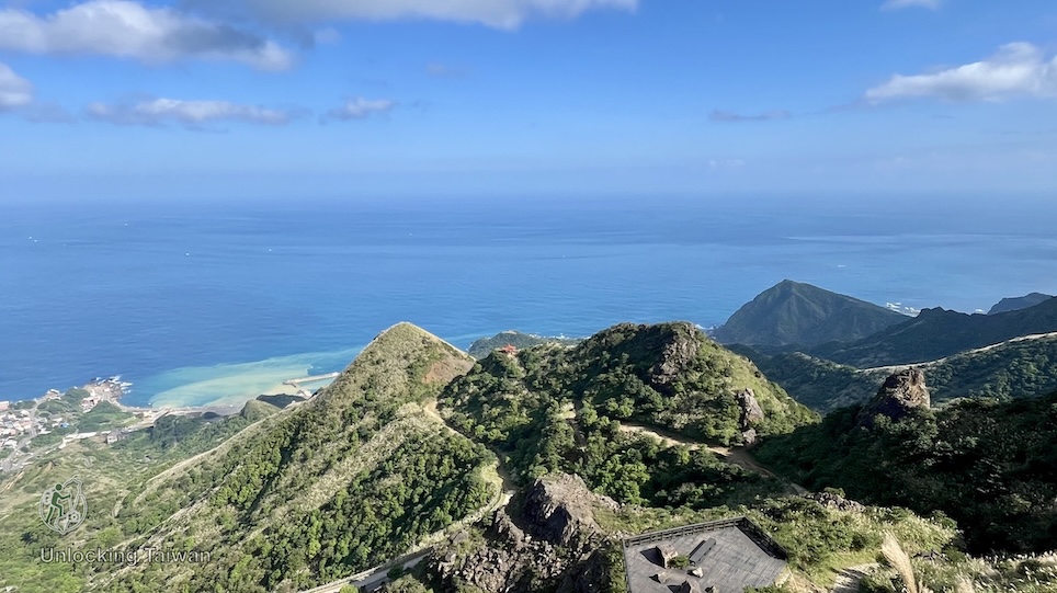
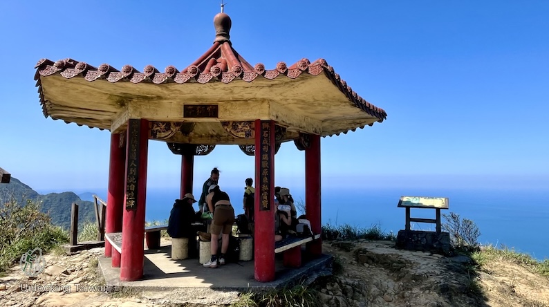
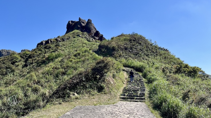
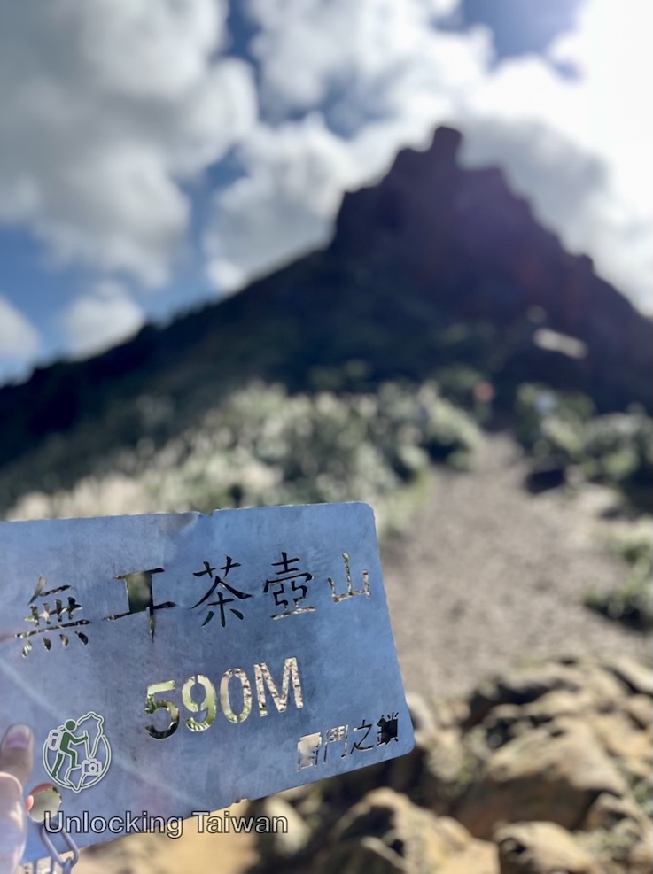
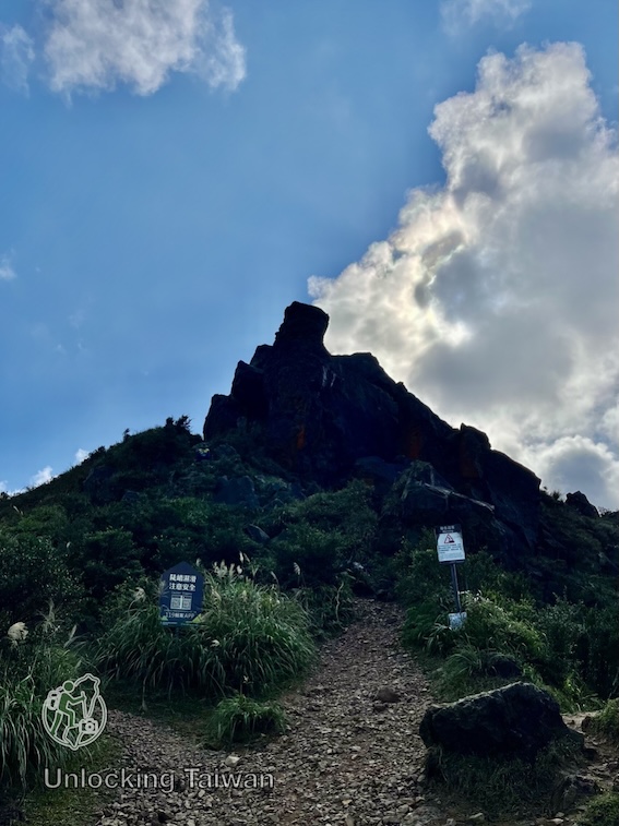
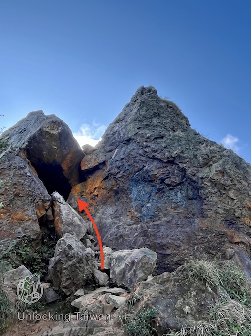
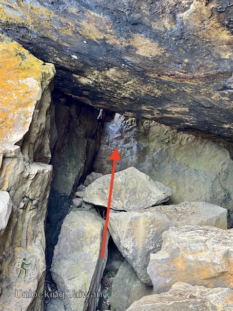
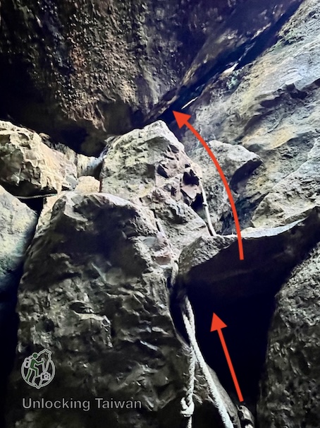
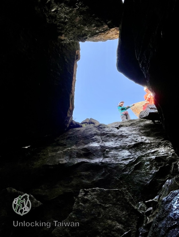
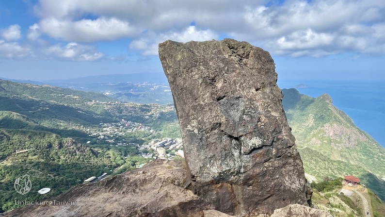
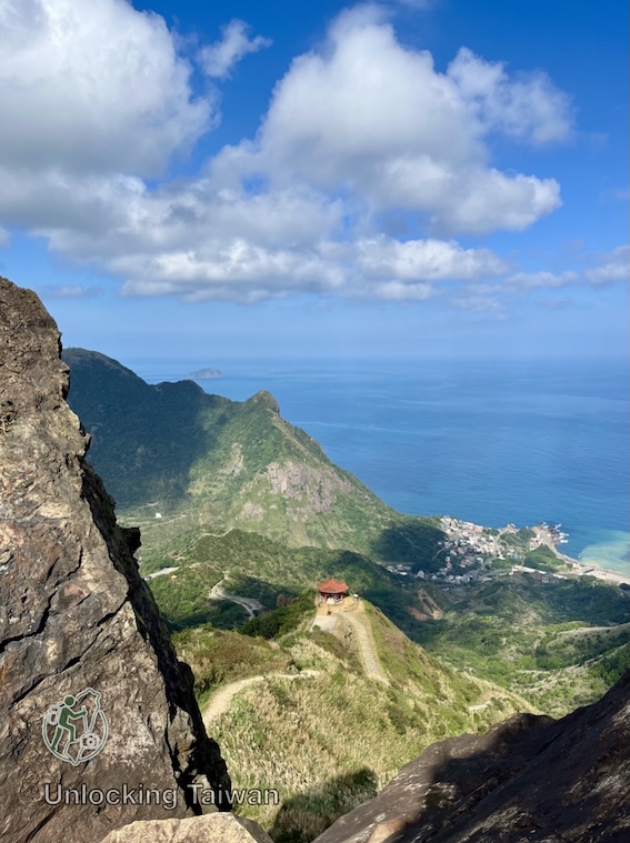
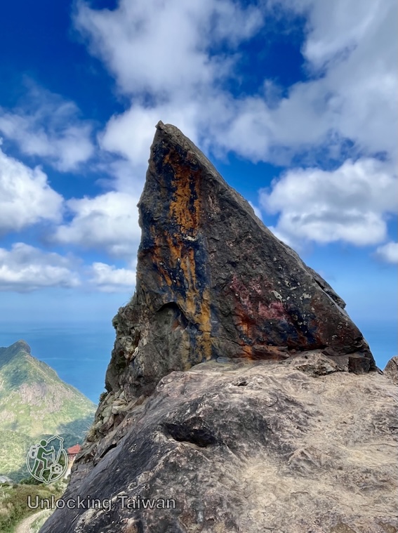
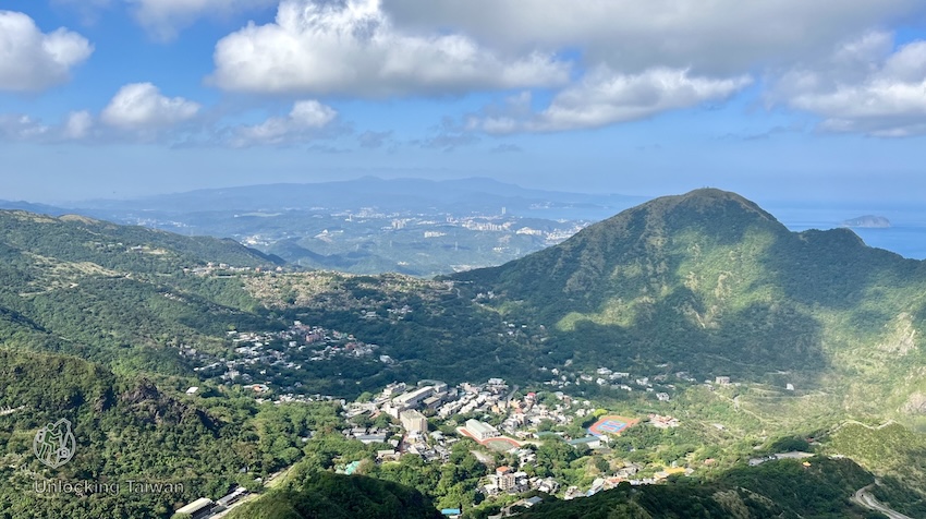
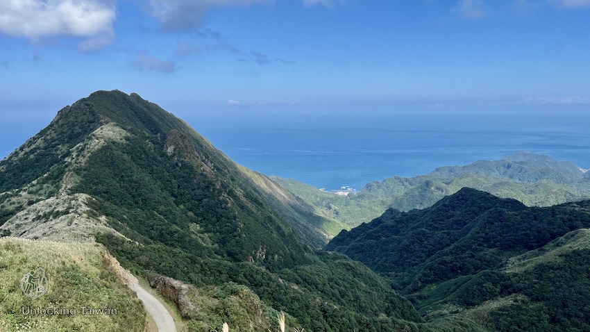
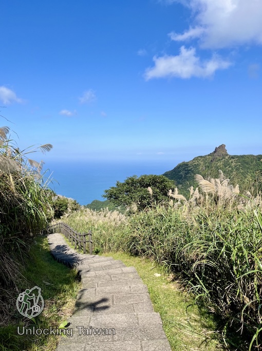
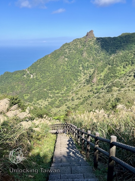
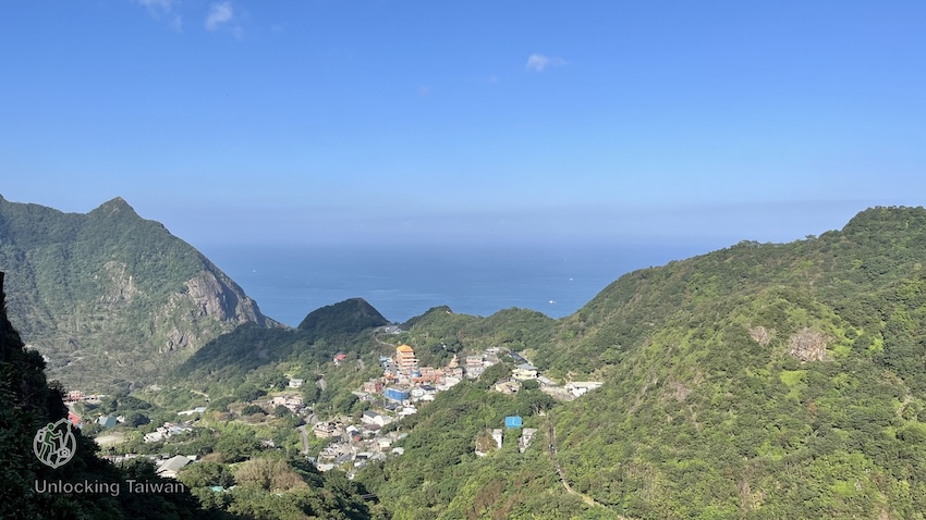
Summit views.
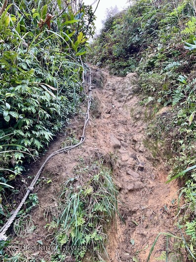
Use extra caution when climbing the rock face above the summit. Ropes and footholds are available.
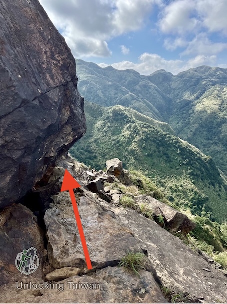
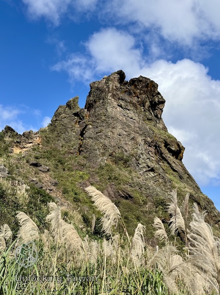
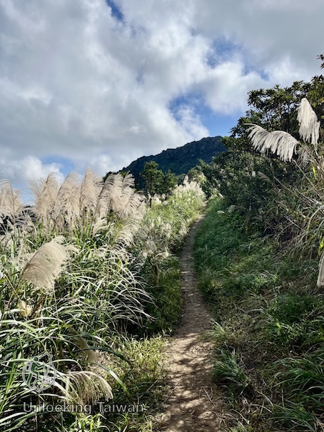
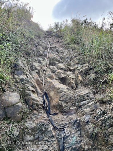
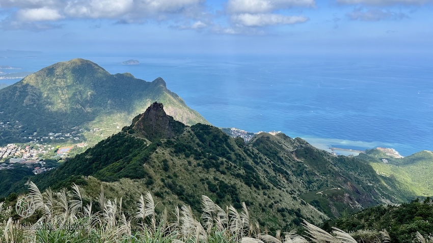
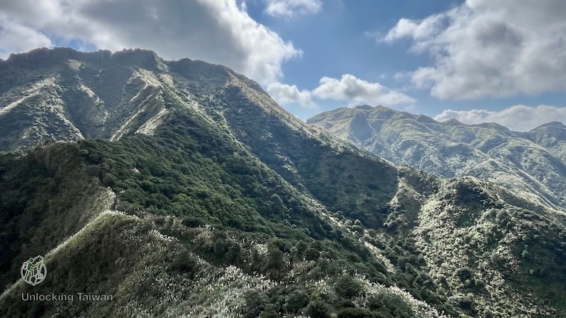
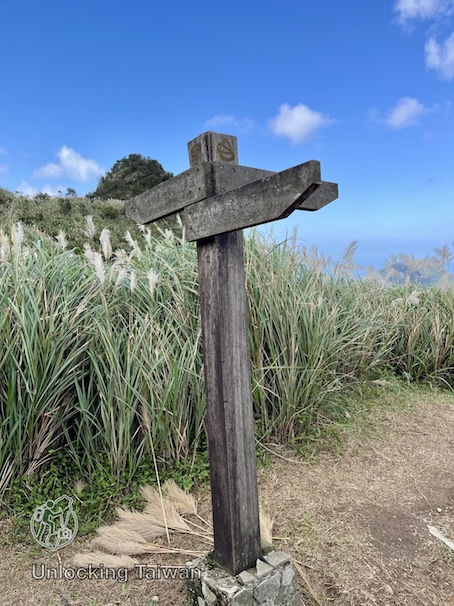
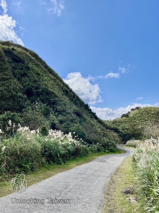
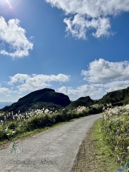
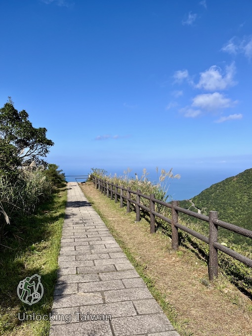
Beautiful views along the trail to Banping Mountain.
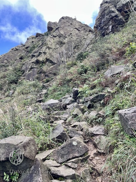
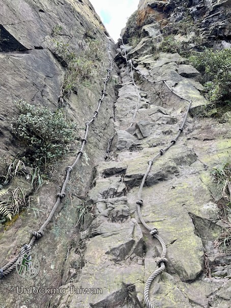
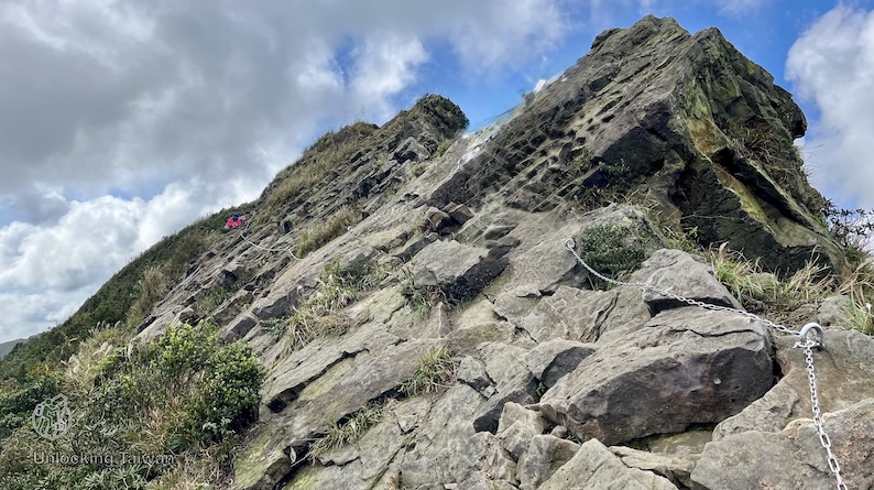
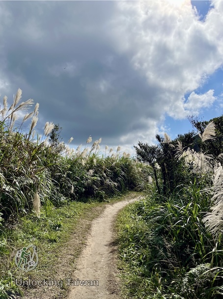
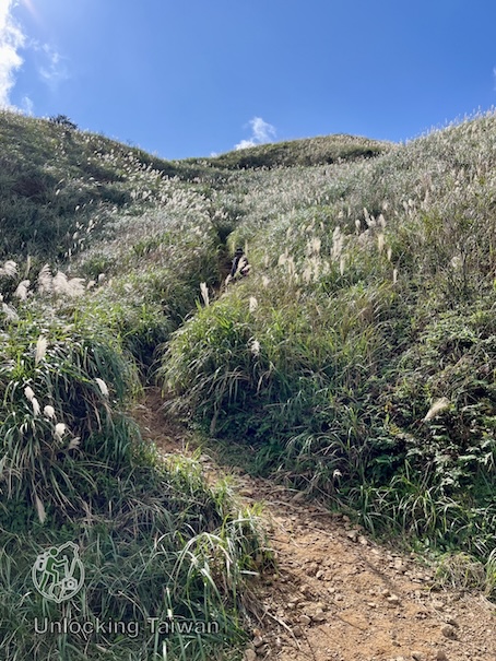
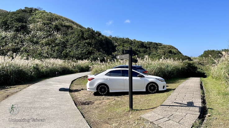
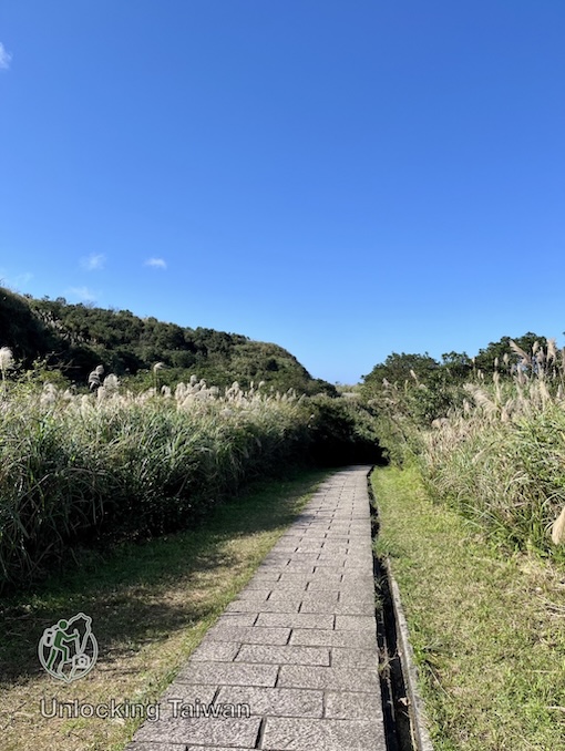
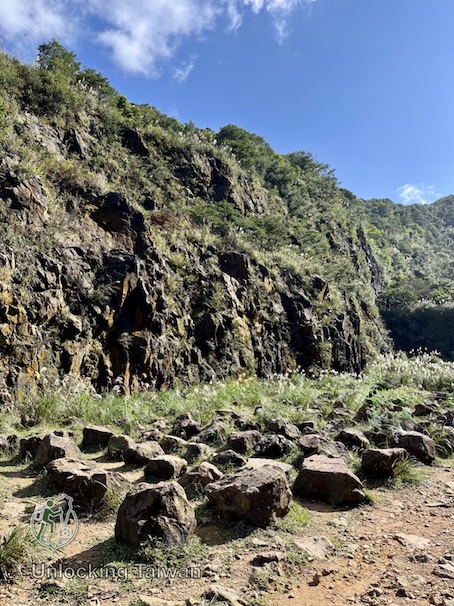
Trail conditions on the way to Banping Mountain.
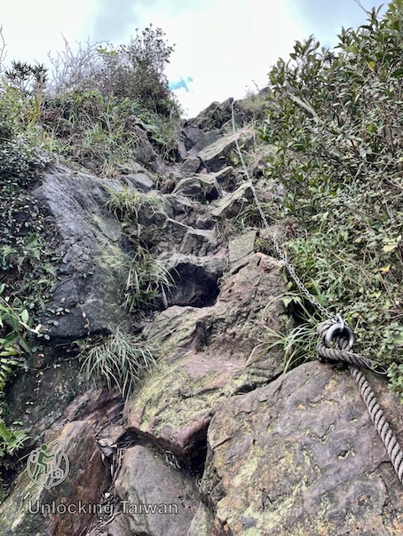

Nearby Attractions
If you have extra time or energy, here are some great spots to check out nearby or on your way back.
Keelung Mountain (基隆山)
Located right next to the Shanjian Road Trail entrance, Keelung Mountain offers one of the best panoramic views over Jiufen and the Pacific. You can hike up this first, then come back down and start your relaxing descent on the Shanjian Road Trail.
Read the full guide → Keelung Mountain (基隆山): Short but Scenic Hike Overlooking Jiufen & the Pacific
Baoshi Mountain Trail (報時山步道) & Liukeng Slope Cableway (六坑斜坡索道)
Often called Taiwan’s shortest sea-view hike, this 10-minute walk offers panoramic views of the Yin-Yang Sea and the 13-Layer Remains.
Nearby, the historic Liukeng Slope Cableway offers another fascinating glimpse into Jinguashi’s mining heritage.
Read the full guide → Baoshi Mountain Trail (報時山步道): Taiwan’s Shortest Sea-View Hike in Jiufen – Jinguashi
Shanjian Road Trail (山尖路觀光步道)
Looking for a quieter alternative to Jiufen Old Street?
Shanjian Road Trail is a peaceful historic footpath connecting Jiufen and Jinguashi. Along the way, you’ll pass the unique Triple-Tiered Bridge, abandoned mining structures, and the narrow rock passage known as the “Thread of Sky.”
Read the full guide → Shanjian Road Trail (山尖路步道): A Hidden Hiking Trail Near Jiufen with a Rare Three-Layer Bridge
Final Thoughts
The Teapot Mountain, Banping Mountain, and Canguangliao Mountain Traverse is one of the best ridge hikes accessible from Taipei by public transport.
Few trails combine:
- Three famous summits
- Exciting scrambling sections
- Panoramic ocean views
- Historic mining landmarks
- Easy transportation
into a single day hike.
If you want to experience Taiwan’s famous ridge hiking without committing to highly technical terrain, this route should be at the top of your list.
Enjoy your hike through Taiwan’s golden history!
If you found this guide helpful, check out our other [Hiking Guides]!
☕ Support Unlocking Taiwan: If this guide helped you plan your hike, consider supporting Unlocking Taiwan with a coffee. Every contribution helps us create more free, detailed hiking guides for international travelers exploring Taiwan.